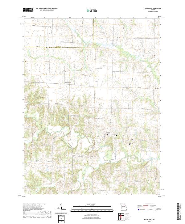
2021 Map of Woodlawn
USGS Topo · Published 2021About this map
Woodlawn sits at the center of this rural Missouri landscape, straddling the northern border of Monroe County where it meets Shelby County. This region is defined by the winding course of the Middle Fork Salt River, which receives numerous tributaries as it flows eastward. Small-scale drainage patterns are visible through the detailed mapping of Little Otter Cr, Flat Cr, and Bear Br, illustrating the gradual erosion of the local topography. This predominantly agricultural area maintains its historical roots through several small family and community burial grounds, such as Atterberry Cem, Milner Cem, and Forest Grove Cem. The map reveals a tight-knit network of county and state routes, including State Hwy J and State Hwy K, which connect the scattered farmsteads and provide access to the river's riparian corridors.
Find a feature on this map
39 named features on this map. Tap any name to fly to it.
Don’t see what you’re looking for? This feature index may not catch every label — zoom into the map to look around manually.
Map Details
Editions of this 2021 Woodlawn Map
This is the sole edition of this map. No revisions or reprints were ever made.
Other maps of this area

1890 · Moberly
USGS Topo · 1:125,000

1908 · Macon
USGS Topo · 1:62,500

1910 · Macon
USGS Topo · 1:62,500

1952 · Middle Grove
USGS Topo · 1:24,000

1953 · Moberly
USGS Topo · 1:250,000

1954 · Moberly
USGS Topo · 1:250,000

1957 · Moberly
USGS Topo · 1:250,000

1958 · Lentner
USGS Topo · 1:24,000

1959 · Shelbina
USGS Topo · 1:24,000
1959 · Woodlawn
USGS Topo · 1:24,000