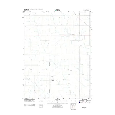
2012 Map of Woodlawn
USGS Topo · Published 2012About this map
Woodlawn and Capioma anchor this rural landscape in Nemaha County, where a strictly geometric grid of section roads meets the winding courses of the Delaware River and its tributaries. The settlement pattern here is deeply rooted in local community and faith, evidenced by the clustered presence of Woodlawn Cem, Capioma Cem, and Saint Augustine's Cem. These landmarks, along with the small crossroads at Fidelity and Fourmile Corners, provide essential points of reference for genealogists tracing family ties to these prairie townships.
Find a feature on this map
47 named features on this map. Tap any name to fly to it.
Don’t see what you’re looking for? This feature index may not catch every label — zoom into the map to look around manually.
Map Details
Editions of this 2012 Woodlawn Map
This is the sole edition of this map. No revisions or reprints were ever made.
Other maps of this area

1888 · Hiawatha
USGS Topo · 1:125,000

1894 · Hiawatha
USGS Topo · 1:125,000

1950 · Kansas City
USGS Topo · 1:250,000

1954 · Kansas City
USGS Topo · 1:250,000

1956 · Kansas City
USGS Topo · 1:250,000
1959 · Morrill
USGS Topo · 1:24,000

1960 · Kansas City
USGS Topo · 1:250,000
1960 · Bern
USGS Topo · 1:24,000
1960 · Sabetha
USGS Topo · 1:24,000

1960 · Fairview
USGS Topo · 1:24,000