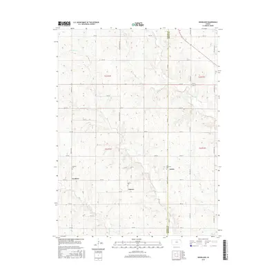
2015 Map of Woodlawn
USGS Topo · Published 2015About this map
Woodlawn, Fidelity, and Capioma anchor this rural landscape along the boundary of Nemaha Co and Brown Co. The terrain is defined by a series of creeks, including Craig Cr and Cedar Cr, which flow toward the Delaware River in the northeast and Muddy Cr in the south. This 2015 survey documents the enduring grid of section roads, such as 168th Rd and 120th Rd, that separate the agricultural plots. Local history and genealogy are preserved in the locations of the Woodlawn Cem, Capioma Cem, and Saint Augustine's Cem, which mark the spiritual and social centers of these small prairie communities. The landscape reflects a stable pattern of land use, where the intersection of township lines like t2s r14e and t3s r15e dictates the placement of homesteads and crossroads settlements.
Find a feature on this map
37 named features on this map. Tap any name to fly to it.
Don’t see what you’re looking for? This feature index may not catch every label — zoom into the map to look around manually.
Map Details
Editions of this 2015 Woodlawn Map
This is the sole edition of this map. No revisions or reprints were ever made.
Other maps of this area

1888 · Hiawatha
USGS Topo · 1:125,000

1894 · Hiawatha
USGS Topo · 1:125,000

1950 · Kansas City
USGS Topo · 1:250,000

1954 · Kansas City
USGS Topo · 1:250,000

1956 · Kansas City
USGS Topo · 1:250,000
1959 · Morrill
USGS Topo · 1:24,000

1960 · Kansas City
USGS Topo · 1:250,000
1960 · Bern
USGS Topo · 1:24,000
1960 · Sabetha
USGS Topo · 1:24,000

1960 · Fairview
USGS Topo · 1:24,000