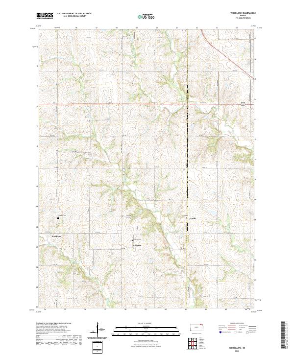
2022 Map of Woodlawn
USGS Topo · Published 2022About this map
The rolling agricultural landscape of eastern Kansas is defined by the headwaters of the Delaware River and its tributaries, such as Craig Cr and Muddy Cr. This part of Nemaha County is characterized by a precise sectional grid of gravel roads, where long-standing community centers like Woodlawn and Capioma serve as anchors for local heritage. The map highlights the intersection of family history and geography, featuring several rural burial grounds including Woodlawn Cem, Capioma Cem, and Fidelity Cem. These sites, along with the cluster of buildings at Fidelity, reflect the persistent footprint of 19th-century prairie settlements that continue to shape the region's contemporary identity. The drainage patterns of Cedar Cr weave through the township lines, illustrating the relationship between the natural water network and the surveyed boundaries of t2s r14e and t2s r15e.
Find a feature on this map
47 named features on this map. Tap any name to fly to it.
Don’t see what you’re looking for? This feature index may not catch every label — zoom into the map to look around manually.
Map Details
Editions of this 2022 Woodlawn Map
This is the sole edition of this map. No revisions or reprints were ever made.
Other maps of this area

1888 · Hiawatha
USGS Topo · 1:125,000

1894 · Hiawatha
USGS Topo · 1:125,000

1950 · Kansas City
USGS Topo · 1:250,000

1954 · Kansas City
USGS Topo · 1:250,000

1956 · Kansas City
USGS Topo · 1:250,000
1959 · Morrill
USGS Topo · 1:24,000

1960 · Kansas City
USGS Topo · 1:250,000
1960 · Bern
USGS Topo · 1:24,000
1960 · Sabetha
USGS Topo · 1:24,000

1960 · Fairview
USGS Topo · 1:24,000