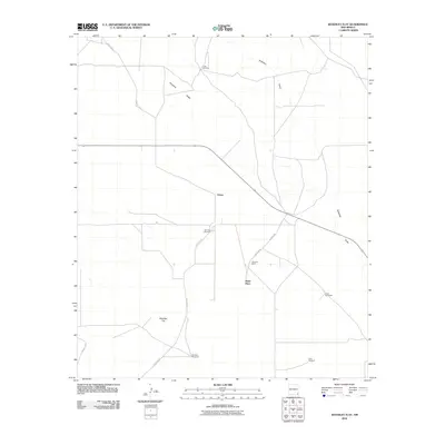
2010 Map of Woodley Flat
USGS Topo · Published 2010About this map
Antelope Ridge and the broad expanse of Woodley Flat define this pocket of Lea County, where water is the primary concern for local inhabitants. The map documents a landscape of sparse settlements and essential infrastructure, notably the network of water sources such as Yates Windmill, Fairview Windmill, and Henry Windmill. These features indicate a ranching economy reliant on subterranean water to support livestock across the arid terrain.
Find a feature on this map
14 named features on this map. Tap any name to fly to it.
Don’t see what you’re looking for? This feature index may not catch every label — zoom into the map to look around manually.
Map Details
Editions of this 2010 Woodley Flat Map
This is the sole edition of this map. No revisions or reprints were ever made.
Other maps of this area

1954 · Hobbs
USGS Topo · 1:250,000

1958 · Hobbs
USGS Topo · 1:250,000

1963 · Oil Center
USGS Topo · 1:62,500

1963 · Hat Mesa
USGS Topo · 1:62,500

1973 · Javelina Basin
USGS Topo · 1:24,000

1973 · Bell Lake
USGS Topo · 1:24,000

1973 · Paduca Breaks East
USGS Topo · 1:24,000

1973 · Custer Mountain
USGS Topo · 1:24,000
1973 · Andrews Place
USGS Topo · 1:24,000
1973 · Woodley Flat
USGS Topo · 1:24,000