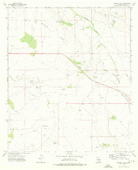
1973 Map of Woodley Flat
USGS Topo · Published 1976About this map
Antelope Ridge and the broad expanse of Woodley Flat define this corner of the Chihuahuan Desert during the early 1970s. The landscape is a network of ranching and energy infrastructure, where survival for livestock depends on named water catchments like Allison Tank and Johnson Grass Tank, alongside numerous mechanical wells such as the Yates Windmill and Henry Windmill.
Find a feature on this map
24 named features on this map. Tap any name to fly to it.
Don’t see what you’re looking for? This feature index may not catch every label — zoom into the map to look around manually.
Map Details
Editions of this 1973 Woodley Flat Map
This is the sole edition of this map. No revisions or reprints were ever made.
Other maps of this area

1954 · Hobbs
USGS Topo · 1:250,000

1958 · Hobbs
USGS Topo · 1:250,000

1963 · Oil Center
USGS Topo · 1:62,500

1963 · Hat Mesa
USGS Topo · 1:62,500

1973 · Javelina Basin
USGS Topo · 1:24,000

1973 · Bell Lake
USGS Topo · 1:24,000

1973 · Paduca Breaks East
USGS Topo · 1:24,000

1973 · Custer Mountain
USGS Topo · 1:24,000
1973 · Andrews Place
USGS Topo · 1:24,000

1978 · Jal
USGS Topo · 1:100,000