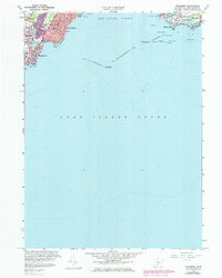
1960 Map of Woodmont
USGS Topo · Published 1960About this map
New Haven Harbor and the northern reaches of Long Island Sound dominate this coastal survey, where maritime navigation is defined by massive engineering projects like the Luddington Rock Breakwater and the West Breakwater. On the western shore, residential expansion is evident in the neighborhoods of Woodmont and West Shore, served by local institutions such as Pagels Sch and Haley Sch. The shoreline is a series of named beaches and rocky points, from Savin Rock down to Merwin Point, reflecting a landscape heavily oriented toward summer recreation and littoral living.
Find a feature on this map
50 named features on this map. Tap any name to fly to it.
Don’t see what you’re looking for? This feature index may not catch every label — zoom into the map to look around manually.
Map Details
Editions of this 1960 Woodmont Map
3 editions found
Other maps of this area

1889 · Derby
USGS Topo · 1:62,500

1891 · Bridgeport
USGS Topo · 1:62,500

1891 · Derby
USGS Topo · 1:62,500

1892 · New Haven
USGS Topo · 1:62,500

1893 · Bridgeport
USGS Topo · 1:62,500

1893 · Derby
USGS Topo · 1:62,500

1920 · Bridgeport
USGS Topo · 1:62,500

1921 · New Haven
USGS Topo · 1:62,500

1943 · New Haven
USGS Topo · 1:31,680

1947 · Hartford
USGS Topo · 1:250,000