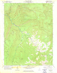
1977 Map of Woodrow
USGS Topo · Published 1978About this map
Turkey Mountain and the high ridges of Yew Mountain dominate this mid-1970s view of Pocahontas County, where high-elevation knobs and deep river valleys define the land. The Williams River snakes through the central landscape, buffered by the dense timber of the Monongahela National Forest. In the southern reaches, the settlement of Woodrow sits near the headwaters of Stony Creek, while the West Union Ch and nearby cemeteries mark the local social and genealogical heart of the community.
Find a feature on this map
37 named features on this map. Tap any name to fly to it.
Don’t see what you’re looking for? This feature index may not catch every label — zoom into the map to look around manually.
Map Details
Editions of this 1977 Woodrow Map
2 editions found
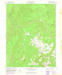
Other maps of this area

1891 · Huntersville
USGS Topo · 1:125,000

1894 · Huntersville
USGS Topo · 1:125,000

1915 · Webster Springs
USGS Topo · 1:48,000

1918 · Webster Springs
USGS Topo · 1:62,500

1923 · Lobelia
USGS Topo · 1:48,000

1923 · Marlinton
USGS Topo · 1:48,000

1923 · Mingo
USGS Topo · 1:48,000

1925 · Mingo
USGS Topo · 1:62,500

1925 · Marlinton
USGS Topo · 1:62,500

1925 · Lobelia
USGS Topo · 1:62,500