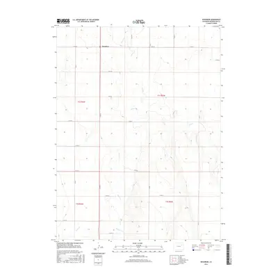
2016 Map of Woodrow
USGS Topo · Published 2016About this map
The high plains of Washington County center on the small community of Woodrow, where a rigid grid of county roads meets the winding, intermittent drainage of the Colorado steppe. Situated at the junction of Co Rd 29 and Co Rd G, this settlement serves as the primary landmark in an expansive agricultural landscape defined by seasonal watercourses like Beaver Cr and Sand Cr. The mapping reflects the precise Public Land Survey System divisions, clearly delineating townships such as t1s r56w and t1s r55w. In the southern reaches, Plum Bush Cr carves a subtle path through the terrain, illustrating the sparse but vital hydrography that has shaped the ranching and farming history of the region. This survey captures the intersection of modern rural infrastructure and the enduring natural features of the eastern plains.
Find a feature on this map
24 named features on this map. Tap any name to fly to it.
Don’t see what you’re looking for? This feature index may not catch every label — zoom into the map to look around manually.
Map Details
Editions of this 2016 Woodrow Map
This is the sole edition of this map. No revisions or reprints were ever made.
Other maps of this area

1954 · Limon
USGS Topo · 1:250,000

1954 · Sterling
USGS Topo · 1:250,000

1957 · Limon
USGS Topo · 1:250,000

1958 · Limon
USGS Topo · 1:250,000

1958 · Sterling
USGS Topo · 1:250,000

1965 · Gary
USGS Topo · 1:24,000

1965 · Huey Ranch
USGS Topo · 1:24,000

1973 · Woodrow
USGS Topo · 1:24,000

1973 · Antelope Creek West
USGS Topo · 1:24,000

1973 · Dry Gulch
USGS Topo · 1:24,000