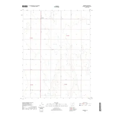
2019 Map of Woodrow
USGS Topo · Published 2019About this map
Woodrow serves as the central hub of this High Plains landscape in Washington County, situated at the intersection of Co Rd G and Co Rd 29. The terrain is defined by a series of intermittent drainage systems that move across the prairie, including the winding paths of Beaver Cr, Sand Cr, and Plum Bush Cr. This 2019 survey illustrates a highly organized section-line road grid, where routes like Co Rd 24 and Co Rd J facilitate access across the vast agricultural and ranching parcels. The map detail highlights the sparse settlement pattern typical of this region, where individual homesteads are separated by wide stretches of open land and seasonal watercourses, reflecting the endurance of rural life in eastern Colorado.
Find a feature on this map
24 named features on this map. Tap any name to fly to it.
Don’t see what you’re looking for? This feature index may not catch every label — zoom into the map to look around manually.
Map Details
Editions of this 2019 Woodrow Map
This is the sole edition of this map. No revisions or reprints were ever made.
Other maps of this area

1954 · Limon
USGS Topo · 1:250,000

1954 · Sterling
USGS Topo · 1:250,000

1957 · Limon
USGS Topo · 1:250,000

1958 · Limon
USGS Topo · 1:250,000

1958 · Sterling
USGS Topo · 1:250,000

1965 · Gary
USGS Topo · 1:24,000

1965 · Huey Ranch
USGS Topo · 1:24,000

1973 · Woodrow
USGS Topo · 1:24,000

1973 · Antelope Creek West
USGS Topo · 1:24,000

1973 · Dry Gulch
USGS Topo · 1:24,000