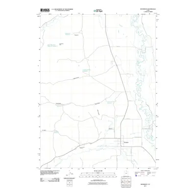
2011 Map of Woodruff
USGS Topo · Published 2011About this map
Woodruff serves as the primary hub in this corner of Rich County, where the meandering Bear River flows through a landscape defined by water management and high-country relief. The settlement is anchored by the Woodruff Cemetery and the Eastman Family Cemetery, reflecting the deep familial roots of this agricultural community. To the east, the terrain rises toward Little Crawford Mountain, while the western hills are dotted with livestock-supporting infrastructure like Limestone Reservoir, Higgins Hollow Reservoir, and South Big Creek Reservoir Number 2.
Find a feature on this map
32 named features on this map. Tap any name to fly to it.
Don’t see what you’re looking for? This feature index may not catch every label — zoom into the map to look around manually.
Map Details
Editions of this 2011 Woodruff Map
This is the sole edition of this map. No revisions or reprints were ever made.
Other maps of this area

1912 · Randolph
USGS Topo · 1:125,000

1954 · Ogden
USGS Topo · 1:250,000

1958 · Ogden
USGS Topo · 1:250,000

1960 · Ogden
USGS Topo · 1:250,000

1968 · Rex Peak
USGS Topo · 1:24,000

1968 · Randolph
USGS Topo · 1:24,000

1968 · Woodruff
USGS Topo · 1:24,000

1968 · Neponset Reservoir NE
USGS Topo · 1:24,000

1968 · Meachum Ridge
USGS Topo · 1:24,000
1968 · Woodruff Narrows
USGS Topo · 1:24,000