
1968 Map of Meachum Ridge
USGS Topo · Published 1971About this map
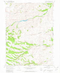
Woodruff Creek flows through the center of this high-elevation landscape in Rich County, where the topography transitions from the eastern slopes of Strawberry Ridge toward the Cache National Forest. The presence of the Woodruff Creek Dam and its associated spillway highlights the importance of water management in this arid stretch of northeastern Utah. A Gaging Station downstream on Woodruff Creek and another on Birch Creek further emphasize the systematic monitoring of these mountain drainages.
Find a feature on this map
25 named features on this map. Tap any name to fly to it.
Don’t see what you’re looking for? This feature index may not catch every label — zoom into the map to look around manually.
Map Details
Editions of this 1968 Meachum Ridge Map
3 editions found
Other maps of this area

1912 · Randolph
USGS Topo · 1:125,000

1954 · Ogden
USGS Topo · 1:250,000

1958 · Ogden
USGS Topo · 1:250,000

1960 · Ogden
USGS Topo · 1:250,000

1968 · Horse Ridge
USGS Topo · 1:24,000

1968 · Dairy Ridge
USGS Topo · 1:24,000

1968 · Woodruff
USGS Topo · 1:24,000

1968 · Mc Kay Hollow
USGS Topo · 1:24,000

1968 · Peck Canyon
USGS Topo · 1:24,000
1968 · Neponset Reservoir NW
USGS Topo · 1:24,000