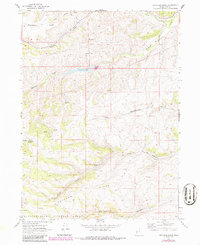
1968 Map of Meachum Ridge
USGS Topo · Published 1986About this map
Meachum Ridge dominates this northern Utah landscape, where the high country of the Wasatch-Cache National Forest meets a network of vital waterways and historical ranching corridors. Based on 1960s field data with mid-1980s photorevisions, the map documents the management of water resources in this arid terrain, anchored by the Woodruff Creek Reservoir and its spillway. A gaging station along Birch Creek reflects the systematic monitoring of runoff through the numerous drainages like Wheatgrass Hollow and Allan Hollow. The rugged topography is defined by prominent rises such as Strawberry Ridge and Red Mountain, while a system of pack trails and jeep trails provides the only access through the steep Meachum Canyon and Home Canyon. This survey captures the region just as modern mapping techniques began to overlay new infrastructure on traditional grazing lands.
Find a feature on this map
20 named features on this map. Tap any name to fly to it.
Don’t see what you’re looking for? This feature index may not catch every label — zoom into the map to look around manually.
Map Details
Editions of this 1968 Meachum Ridge Map
3 editions found
Other maps of this area

1912 · Randolph
USGS Topo · 1:125,000

1954 · Ogden
USGS Topo · 1:250,000

1958 · Ogden
USGS Topo · 1:250,000

1960 · Ogden
USGS Topo · 1:250,000

1968 · Horse Ridge
USGS Topo · 1:24,000

1968 · Dairy Ridge
USGS Topo · 1:24,000

1968 · Woodruff
USGS Topo · 1:24,000

1968 · Mc Kay Hollow
USGS Topo · 1:24,000

1968 · Meachum Ridge
USGS Topo · 1:24,000

1968 · Peck Canyon
USGS Topo · 1:24,000