
1968 Map of Mc Kay Hollow
USGS Topo · Published 1971About this map
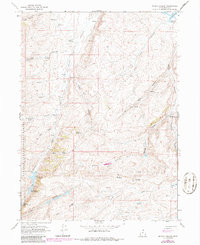
Cache National Forest encompasses the western portion of this 1968 landscape, characterized by a series of named hollows and ridges that define the water management patterns of Rich County. The terrain is marked by a complex network of seasonal drainages such as Saleratus Creek and Crane Creek, which feed into specialized ranching or agricultural infrastructure like Saleratus Reservoir No 1 and its sister reservoirs to the south.
Find a feature on this map
28 named features on this map. Tap any name to fly to it.
Don’t see what you’re looking for? This feature index may not catch every label — zoom into the map to look around manually.
Map Details
Editions of this 1968 Mc Kay Hollow Map
2 editions found
Other maps of this area

1954 · Ogden
USGS Topo · 1:250,000

1958 · Ogden
USGS Topo · 1:250,000

1960 · Ogden
USGS Topo · 1:250,000

1964 · Francis Canyon
USGS Topo · 1:24,000

1968 · Wahsatch
USGS Topo · 1:24,000

1968 · Shearing Corral
USGS Topo · 1:24,000

1968 · Neponset Reservoir NE
USGS Topo · 1:24,000

1968 · Meachum Ridge
USGS Topo · 1:24,000

1968 · Peck Canyon
USGS Topo · 1:24,000
1968 · Murphy Ridge
USGS Topo · 1:24,000