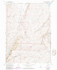
1968 Map of Mc Kay Hollow
USGS Topo · Published 1986About this map
Water management and grazing land define the high country of Rich County on this late-1960s survey. The terrain is marked by a series of high-altitude water storage points, including Neponset Reservoir and the tiered Saleratus Reservoir No 1, Saleratus Reservoir No 2, and Saleratus Reservoir No 3 located near Saleratus Creek. These reservoirs, along with numerous named springs like Chicken Spring and Negro Dan Spring, suggest a landscape historically utilized for livestock and seasonal irrigation.
Find a feature on this map
29 named features on this map. Tap any name to fly to it.
Don’t see what you’re looking for? This feature index may not catch every label — zoom into the map to look around manually.
Map Details
Editions of this 1968 Mc Kay Hollow Map
2 editions found
Other maps of this area

1954 · Ogden
USGS Topo · 1:250,000

1958 · Ogden
USGS Topo · 1:250,000

1960 · Ogden
USGS Topo · 1:250,000

1964 · Francis Canyon
USGS Topo · 1:24,000

1968 · Wahsatch
USGS Topo · 1:24,000

1968 · Shearing Corral
USGS Topo · 1:24,000

1968 · Mc Kay Hollow
USGS Topo · 1:24,000

1968 · Neponset Reservoir NE
USGS Topo · 1:24,000

1968 · Meachum Ridge
USGS Topo · 1:24,000

1968 · Peck Canyon
USGS Topo · 1:24,000