
1968 Map of Wahsatch
USGS Topo · Published 1970About this map
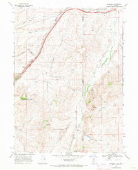
Wahsatch stands as the primary settlement on this high-desert plateau, positioned near the dramatic geological formations of The Needles and the rugged passage of Echo Canyon. The landscape is a corridor of historical movement, where the massive infrastructure of the Union Pacific railroad parallels the ancient route of the Emigrant Trail. This intersection of rail and trail illustrates the region's enduring role as a gateway through the mountains, while numerous water sources like Slaughterhouse Creek, Yellow Creek, and Suttons Springs dictate the patterns of local ranching and land use.
Find a feature on this map
25 named features on this map. Tap any name to fly to it.
Don’t see what you’re looking for? This feature index may not catch every label — zoom into the map to look around manually.
Map Details
Editions of this 1968 Wahsatch Map
2 editions found
Other maps of this area

1954 · Ogden
USGS Topo · 1:250,000

1958 · Ogden
USGS Topo · 1:250,000

1960 · Ogden
USGS Topo · 1:250,000

1965 · Evanston
USGS Topo · 1:24,000

1965 · Myers Reservoir
USGS Topo · 1:24,000

1965 · Millis
USGS Topo · 1:24,000
1968 · Porcupine Ridge
USGS Topo · 1:24,000

1968 · Shearing Corral
USGS Topo · 1:24,000

1968 · Mc Kay Hollow
USGS Topo · 1:24,000
1968 · Murphy Ridge
USGS Topo · 1:24,000