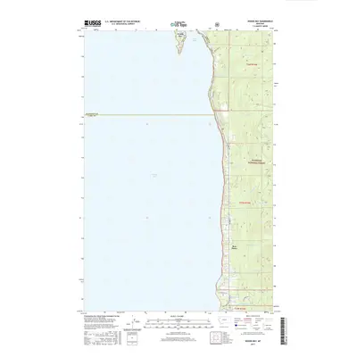
2017 Map of Woods Bay
USGS Topo · Published 2017About this map
Flathead Lake dominates the western half of this quadrangle, defining the shoreline where the Flathead National Forest meets the water. Along the eastern bank, small settlements like Woods Bay and Bear Dance are linked by E Shore Rd, showing the residential development tucked between the lake and the rising mountainous terrain. The map records a landscape carved by numerous small drainages, including Hunger Cr, Mauzey Cr, and the uniquely named No-see-um Cr. The southern portion includes Yellow Bay and the specialized Bio Station Ln, indicating the presence of scientific research facilities along the coast. This 2017 survey details the intersection of recreation and conservation as private lanes like Birch Tree Dr and Lolo Point Ln reach toward the water from the edges of the national forest boundary.
Find a feature on this map
29 named features on this map. Tap any name to fly to it.
Don’t see what you’re looking for? This feature index may not catch every label — zoom into the map to look around manually.
Map Details
Editions of this 2017 Woods Bay Map
This is the sole edition of this map. No revisions or reprints were ever made.
Other maps of this area

1914 · Nyack
USGS Topo · 1:125,000

1920 · Flathead Lake
USGS Topo · 1:125,000

1943 · Kalispell
USGS Topo · 1:125,000

1955 · Choteau
USGS Topo · 1:250,000

1956 · Wallace
USGS Topo · 1:250,000

1957 · Choteau
USGS Topo · 1:250,000

1957 · Kalispell
USGS Topo · 1:250,000

1958 · Choteau
USGS Topo · 1:250,000

1960 · Kalispell
USGS Topo · 1:250,000

1960 · Wallace
USGS Topo · 1:250,000