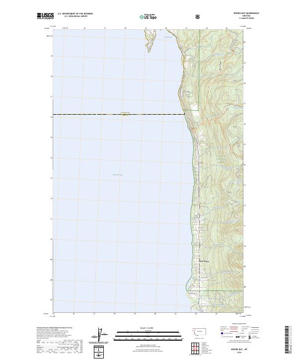
2024 Map of Woods Bay
USGS Topo · Published 2024About this map
Woods Bay and the settlement of Bear Dance occupy the narrow, inhabited strip between the eastern shore of Flathead Lake and the rising elevations of the Mission Range. This shoreline is defined by a series of points and inlets, most notably Yenne Point, where residential development is concentrated along E Shore Rd and Tamarac Dr. The landscape shifts abruptly from the water's edge to the protected wilderness of the Flathead National Forest, where steep drainages such as No-see-em Creek, Gunderson Creek, and Hunger Creek descend toward the lake. The map illustrates the contemporary interface of lakeside communities and managed forest land, with a network of trails including the Phillips Trl and Bear Dance Trl providing access into the higher terrain of the Mission Range.
Find a feature on this map
33 named features on this map. Tap any name to fly to it.
Don’t see what you’re looking for? This feature index may not catch every label — zoom into the map to look around manually.
Map Details
Editions of this 2024 Woods Bay Map
This is the sole edition of this map. No revisions or reprints were ever made.
Other maps of this area

1914 · Nyack
USGS Topo · 1:125,000

1920 · Flathead Lake
USGS Topo · 1:125,000

1943 · Kalispell
USGS Topo · 1:125,000

1955 · Choteau
USGS Topo · 1:250,000

1956 · Wallace
USGS Topo · 1:250,000

1957 · Choteau
USGS Topo · 1:250,000

1957 · Kalispell
USGS Topo · 1:250,000

1958 · Choteau
USGS Topo · 1:250,000

1960 · Kalispell
USGS Topo · 1:250,000

1960 · Wallace
USGS Topo · 1:250,000