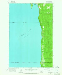
1964 Map of Woods Bay
USGS Topo · Published 1966About this map
Flathead Lake dominates the western half of this mid-century survey, revealing a landscape defined by the steep transition from the water's edge to the timbered heights of the Flathead National Forest. The eastern shore is a narrow corridor of development along U.S. 93, where small clusters of settlement like Woods Bay and the Flathead Community Center serve as anchors for the local population. Numerous small drainages, including Hungry Creek, Howsley Creek, and the curiously named No-see-em Creek, cut westward through the forest toward the lake.
Find a feature on this map
26 named features on this map. Tap any name to fly to it.
Don’t see what you’re looking for? This feature index may not catch every label — zoom into the map to look around manually.
Map Details
Editions of this 1964 Woods Bay Map
This is the sole edition of this map. No revisions or reprints were ever made.
Other maps of this area

1914 · Nyack
USGS Topo · 1:125,000

1920 · Flathead Lake
USGS Topo · 1:125,000

1943 · Kalispell
USGS Topo · 1:125,000

1955 · Choteau
USGS Topo · 1:250,000

1956 · Wallace
USGS Topo · 1:250,000

1957 · Choteau
USGS Topo · 1:250,000

1957 · Kalispell
USGS Topo · 1:250,000

1958 · Choteau
USGS Topo · 1:250,000

1960 · Kalispell
USGS Topo · 1:250,000

1960 · Wallace
USGS Topo · 1:250,000