
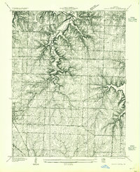
1934 Map of Woods Chapel
USGS Topo · Published 1934About this map
Little Blue River and its tributary Cowherd Creek carve through the Jackson County landscape, defining the topography of this 1934 survey. The area is characterized by a network of rural school districts, including Colborn Sch, Tennyson Sch, and Center Point Sch, which served the farming communities before widespread consolidation. To the east, the early footprint of Lake Lotawana is visible, showing the shoreline as it appeared just years after its initial development. Transport in the region relied on the Missouri Pacific and Chicago Rock Island & Pacific railroads, which cross the southern terrain near Lees Summit. The map also records localized landmarks like Camp Refah and the agricultural tracts of Highland Farms, offering a detailed view of the transition between the rolling river valley and the expanding suburban fringe.
Find a feature on this map
23 named features on this map. Tap any name to fly to it.
Don’t see what you’re looking for? This feature index may not catch every label — zoom into the map to look around manually.
Map Details
Editions of this 1934 Woods Chapel Map
2 editions found
Other maps of this area

1887 · Harrisonville
USGS Topo · 1:125,000

1892 · Harrisonville
USGS Topo · 1:125,000

1894 · Harrisonville
USGS Topo · 1:125,000

1894 · Independence
USGS Topo · 1:125,000

1933 · Blue Springs
USGS Topo · 1:24,000

1934 · Oak Grove
USGS Topo · 1:24,000

1934 · Independence
USGS Topo · 1:24,000

1934 · Lees Summit
USGS Topo · 1:24,000

1935 · Tarsney
USGS Topo · 1:24,000

1939 · Lees Summit
USGS Topo · 1:31,680