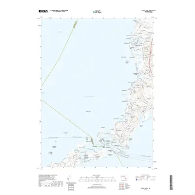
2018 Map of Woods Hole
USGS Topo · Published 2018About this map
Woods Hole and the surrounding coastline of Buzzards Bay are detailed in this 2018 survey, illustrating the complex geography of the Upper Cape. The map highlights the critical maritime infrastructure connecting the mainland to the islands, including the Martha's Vineyard and Woods Hole Ferry and the New Bedford - Oak Bluffs Ferry. Inland, the landscape is defined by its glacial heritage, featuring named elevations like Telegraph Hill and Swifts Hill alongside numerous salt ponds and marshes. Settlements such as West Falmouth and Quissett show a dense network of residential streets, while the historic Crowell Cem remains a notable landmark for genealogists. The proximity of Great Sippewisset Marsh and Little Sippewisset Marsh demonstrates the preserved natural character of the shoreline between developed coastal communities like Saconesset Hills.
Find a feature on this map
155 named features on this map. Tap any name to fly to it.
Don’t see what you’re looking for? This feature index may not catch every label — zoom into the map to look around manually.
Map Details
Editions of this 2018 Woods Hole Map
This is the sole edition of this map. No revisions or reprints were ever made.
Other maps of this area

1885 · New Bedford
USGS Topo · 1:62,500

1886 · Falmouth
USGS Topo · 1:62,500

1887 · Gay Head
USGS Topo · 1:62,500

1887 · Marthas Vineyard
USGS Topo · 1:62,500

1888 · New Bedford
USGS Topo · 1:62,500

1888 · Falmouth
USGS Topo · 1:62,500

1889 · Gay Head
USGS Topo · 1:62,500

1889 · Marthas Vineyard
USGS Topo · 1:62,500

1893 · Gay Head
USGS Topo · 1:62,500

1893 · Falmouth
USGS Topo · 1:62,500