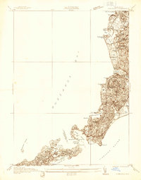
1936 Map of Woods Hole
USGS Topo · Published 1936About this map
Woods Hole serves as the focal point of this coastal survey, highlighting the intricate maritime geography of the Elizabeth Islands and the Falmouth coastline in the mid-1930s. The map traces the rugged interface between Buzzards Bay and Vineyard Sound, documenting the specific channels like Woods Hole Passage and the protected inlets of Hadley Harbor and Quamquisset Harbor. Large private estates and early 20th-century recreational landmarks are visible, including the Falmouth Country Club and the residential layout of Penzance Pt.
Find a feature on this map
59 named features on this map. Tap any name to fly to it.
Don’t see what you’re looking for? This feature index may not catch every label — zoom into the map to look around manually.
Map Details
Editions of this 1936 Woods Hole Map
This is the sole edition of this map. No revisions or reprints were ever made.
Other maps of this area

1885 · New Bedford
USGS Topo · 1:62,500

1886 · Falmouth
USGS Topo · 1:62,500

1887 · Gay Head
USGS Topo · 1:62,500

1887 · Marthas Vineyard
USGS Topo · 1:62,500

1888 · New Bedford
USGS Topo · 1:62,500

1888 · Falmouth
USGS Topo · 1:62,500

1889 · Gay Head
USGS Topo · 1:62,500

1889 · Marthas Vineyard
USGS Topo · 1:62,500

1893 · Gay Head
USGS Topo · 1:62,500

1893 · Falmouth
USGS Topo · 1:62,500