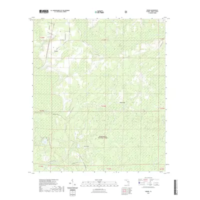
2021 Map of Woods
USGS Topo · Published 2021About this map
The Apalachicola National Forest defines the character of this 2021 survey, covering a vast expanse of Liberty County wetlands and forest. The small settlement of Woods and the historical crossing at Fawn Ford anchor a landscape otherwise dominated by intricate hydrologic features. The map details a labyrinth of low-lying terrain, including Mud Swamp, Johnson Swamp, and numerous "bays" such as Wolf Pond Bay and Washington Bay, which represent typical Florida Panhandle karst or seepage wetlands.
Find a feature on this map
59 named features on this map. Tap any name to fly to it.
Don’t see what you’re looking for? This feature index may not catch every label — zoom into the map to look around manually.
Map Details
Editions of this 2021 Woods Map
This is the sole edition of this map. No revisions or reprints were ever made.
Other maps of this area

1944 · Queens Bay
USGS Topo · 1:24,000

1945 · Blountstown
USGS Topo · 1:31,680

1945 · Hosford
USGS Topo · 1:31,680

1945 · Estiffanulga
USGS Topo · 1:31,680

1945 · Orange
USGS Topo · 1:31,680

1945 · Bristol
USGS Topo · 1:31,680

1945 · Woods
USGS Topo · 1:31,680

1945 · Telogia
USGS Topo · 1:24,000

1946 · Queens Bay
USGS Topo · 1:31,680

1946 · Telogia
USGS Topo · 1:31,680