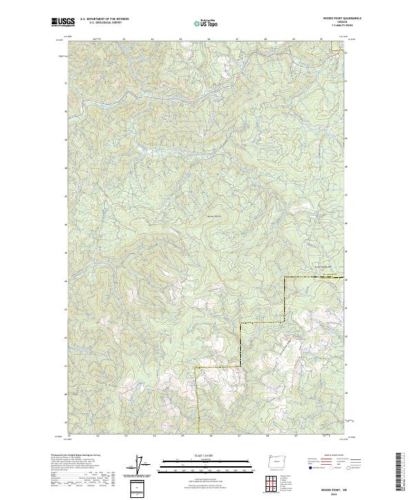
2024 Map of Woods Point
USGS Topo · Published 2024About this map
Woods Point stands at the heart of this coastal range landscape, marking a terrain defined by the complex drainage systems of the Wilson River and the North Fork North Fork Trask River. The map reveals an intensive network of forest management roads and timber access routes, such as the Stimson Mainline Rd, Seven Cedars Rd, and the curiously named Idiot Creek Loop. These paths navigate the steep divides between Grindstone Ridge and Hembre Ridge, illustrating the modern infrastructure required to traverse the high elevations of the Tillamook and Washington county line. Water features are central to the geography here, from the cascading University Falls to the various forks of Elk Creek and Jordan Creek. The transition from the South Saddle Mtn area down to the valley floors shows the characteristic pattern of Pacific Northwest industrial forestry and watershed protection.
Find a feature on this map
47 named features on this map. Tap any name to fly to it.
Don’t see what you’re looking for? This feature index may not catch every label — zoom into the map to look around manually.
Map Details
Editions of this 2024 Woods Point Map
This is the sole edition of this map. No revisions or reprints were ever made.
Other maps of this area

1937 · Enright
USGS Topo · 1:62,500

1941 · Timber
USGS Topo · 1:62,500

1941 · Enright
USGS Topo · 1:62,500

1942 · Ginger Peak
USGS Topo · 1:62,500

1942 · Fairdale
USGS Topo · 1:62,500

1948 · Vancouver
USGS Topo · 1:250,000

1950 · Vancouver
USGS Topo · 1:250,000

1950 · Vancouver
USGS Topo · 1:250,000

1955 · Blaine
USGS Topo · 1:62,500

1955 · Timber
USGS Topo · 1:62,500