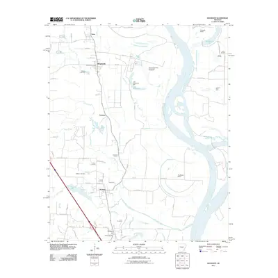
2011 Map of Woodson
USGS Topo · Published 2011About this map
The Arkansas River forms a complex, shifting corridor through this part of Pulaski County, defined by the Little Rock Gillett Levee and the large forms of Chenault Island and Jim Brown Island. The lowland character of the region is evident in the dense network of waterways like Pennington Bayou, Clark Bayou, and Campbell Bayou, which wind between the established settlements of Wrightsville, Woodson, and Hensley.
Find a feature on this map
78 named features on this map. Tap any name to fly to it.
Don’t see what you’re looking for? This feature index may not catch every label — zoom into the map to look around manually.
Map Details
Editions of this 2011 Woodson Map
This is the sole edition of this map. No revisions or reprints were ever made.
Other maps of this area

1891 · Little Rock
USGS Topo · 1:125,000

1893 · Little Rock
USGS Topo · 1:125,000

1932 · Pastoria
USGS Topo · 1:62,500

1935 · Little Rock
USGS Topo · 1:24,000

1935 · Sweet Home
USGS Topo · 1:24,000

1935 · Alexander
USGS Topo · 1:48,000

1935 · Pastoria
USGS Topo · 1:62,500

1939 · Keo
USGS Topo · 1:31,680

1940 · Woodson
USGS Topo · 1:31,680

1941 · Alexander
USGS Topo · 1:62,500