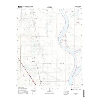
2017 Map of Woodson
USGS Topo · Published 2017About this map
The Arkansas River carves a massive, winding path through this central Arkansas landscape, creating a series of bends, islands, and backwater reaches. Settlements like Woodson, Wrightsville, and Hensley are situated along the western corridor, separated from the river by a complex network of wetlands and bayous. The drainage pattern is particularly intricate here, with Pennington Bayou and Clark Bayou meandering through low-lying areas near Kuykendall Brake and Big Lake.
Find a feature on this map
83 named features on this map. Tap any name to fly to it.
Don’t see what you’re looking for? This feature index may not catch every label — zoom into the map to look around manually.
Map Details
Editions of this 2017 Woodson Map
This is the sole edition of this map. No revisions or reprints were ever made.
Other maps of this area

1891 · Little Rock
USGS Topo · 1:125,000

1893 · Little Rock
USGS Topo · 1:125,000

1932 · Pastoria
USGS Topo · 1:62,500

1935 · Little Rock
USGS Topo · 1:24,000

1935 · Sweet Home
USGS Topo · 1:24,000

1935 · Alexander
USGS Topo · 1:48,000

1935 · Pastoria
USGS Topo · 1:62,500

1939 · Keo
USGS Topo · 1:31,680

1940 · Woodson
USGS Topo · 1:31,680

1941 · Alexander
USGS Topo · 1:62,500