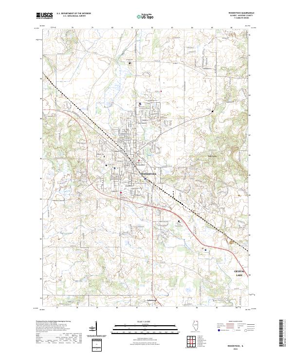
2024 Map of Woodstock
USGS Topo · Published 2024About this map
Woodstock serves as the focal point of this northern Illinois study, anchored by the McHenry County Courthouse and its historic street grid. The town is surrounded by a cluster of established burial grounds, including Oakland Cem and Calvary Cem, which offer significant value for genealogical research in McHenry County. The landscape is defined by the winding course of the Kishwaukee River and numerous glacial water bodies like Lily Pond and Eddy Lake. Toward the south and east, the newer residential developments of Bull Valley and Lakewood appear, connected by arterial routes such as N State Rte 47 and McHenry Ave. This survey details the ongoing suburban expansion as it interfaces with the traditional agricultural and riverine features of the region.
Find a feature on this map
40 named features on this map. Tap any name to fly to it.
Don’t see what you’re looking for? This feature index may not catch every label — zoom into the map to look around manually.
Map Details
Editions of this 2024 Woodstock Map
This is the sole edition of this map. No revisions or reprints were ever made.
Other maps of this area

1925 · Elgin
USGS Topo · 1:62,500

1926 · Mc Henry
USGS Topo · 1:62,500

1932 · Harvard
USGS Topo · 1:48,000

1937 · Harvard
USGS Topo · 1:62,500

1938 · Genoa
USGS Topo · 1:62,500

1940 · Elgin
USGS Topo · 1:62,500

1944 · McHenry
USGS Topo · 1:62,500

1954 · Rockford
USGS Topo · 1:250,000

1955 · Rockford
USGS Topo · 1:250,000

1958 · Rockford
USGS Topo · 1:250,000