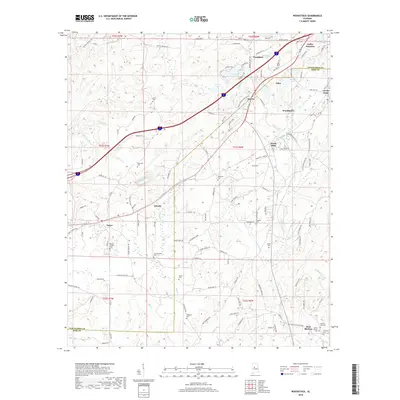
2018 Map of Woodstock
USGS Topo · Published 2018About this map
Woodstock and its surrounding communities sit at the junction of Tuscaloosa and Bibb counties, where the landscape transitions into the rolling hills above West Blocton. This modern survey records a deep network of family and community landmarks, particularly evidenced by the numerous cemeteries like Union Cem, Hopewell Cem, and Bibbville Cem that dot the countryside. The presence of these sites, alongside names like Shuttlesworth Cem and Clements Cem, offers significant genealogical value for those tracing local lineages. Water features define much of the local geography, from the larger Gallant Lake and Woodland Lake to the meandering courses of Johnson Cr and Davis Cr. Small settlements such as Caffee Junction, Docray, and Giles are connected by a web of local roads including Truman Aldrich Pkwy and George Newell Rd, reflecting the modern infrastructure overlaying a historically rural foundation.
Find a feature on this map
134 named features on this map. Tap any name to fly to it.
Don’t see what you’re looking for? This feature index may not catch every label — zoom into the map to look around manually.
Map Details
Editions of this 2018 Woodstock Map
This is the sole edition of this map. No revisions or reprints were ever made.
Other maps of this area

1899 · Brookwood
USGS Topo · 1:125,000

1927 · Adger
USGS Topo · 1:48,000

1929 · Searles
USGS Topo · 1:48,000

1931 · Cottondale
USGS Topo · 1:48,000

1932 · Yolande
USGS Topo · 1:62,500

1934 · Searles
USGS Topo · 1:62,500

1934 · Cottondale
USGS Topo · 1:62,500

1934 · Blocton
USGS Topo · 1:48,000

1935 · Yolande
USGS Topo · 1:62,500

1940 · Blocton
USGS Topo · 1:62,500