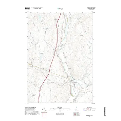
2021 Map of Woodsville
USGS Topo · Published 2021About this map
The Connecticut River serves as the primary boundary between Vermont and New Hampshire on this survey, where the settlements of Wells River and Woodsville face each other across the water. This area exhibits a concentrated cluster of civic and industrial features, including the Ammonoosuc River Reservoir and the Ammonoosuc River confluence. Moving north and west into Vermont, the terrain rises toward Wallace Hill and Leighton Hill, with the village of Boltonville situated along the winding path of the Wells River. Genealogists will find several burial grounds noted, such as Saint Josephs Cem and Blue Mountain Cem, reflecting the deep-rooted community history of the region. The map also captures the distinct rural character of the uplands, marked by features like Ticklenaked Pond and the prominent Gardner Mtn to the east.
Find a feature on this map
97 named features on this map. Tap any name to fly to it.
Don’t see what you’re looking for? This feature index may not catch every label — zoom into the map to look around manually.
Map Details
Editions of this 2021 Woodsville Map
This is the sole edition of this map. No revisions or reprints were ever made.
Other maps of this area

1929 · Moosilauke
USGS Topo · 1:62,500

1931 · Littleton
USGS Topo · 1:62,500

1931 · Woodsville
USGS Topo · 1:48,000

1932 · Littleton
USGS Topo · 1:48,000

1932 · Moosilauke
USGS Topo · 1:62,500

1935 · Woodsville
USGS Topo · 1:62,500

1935 · Littleton
USGS Topo · 1:62,500

1938 · St. Johnsbury
USGS Topo · 1:48,000

1941 · Woodsville
USGS Topo · 1:62,500

1943 · St. Johnsbury
USGS Topo · 1:62,500