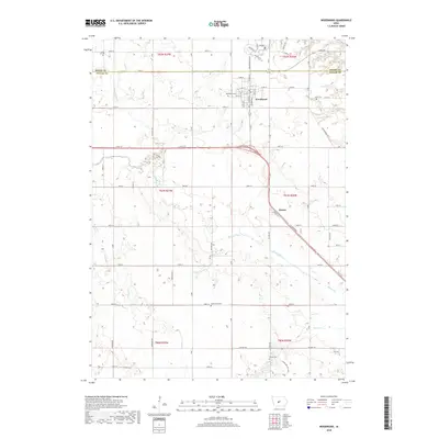
2018 Map of Woodward
USGS Topo · Published 2018About this map
Woodward stands at the northern edge of the Dallas County line, serving as a primary settlement hub along the Iowa prairie. This modern survey reflects the enduring grid of the Public Land Survey System, where section lines dictate the path of rural roads like 130th St and 170th St. The landscape is deeply carved by the drainage of Beaver Creek and its tributaries, including Little Beaver Cr and Slough Cr, which create intricate elevation changes amidst the agricultural fields. Smaller locales like Moran appear along the 141 Diagonal, illustrating the importance of transit corridors in this region. For those researching local heritage, several significant burial grounds are preserved across the townships, including Woodward Cem, Xenia Cem, and the more isolated Beaver Cem and Greenwood Cem.
Find a feature on this map
43 named features on this map. Tap any name to fly to it.
Don’t see what you’re looking for? This feature index may not catch every label — zoom into the map to look around manually.
Map Details
Editions of this 2018 Woodward Map
This is the sole edition of this map. No revisions or reprints were ever made.
Other maps of this area

1908 · Waukee
USGS Topo · 1:62,500

1911 · Madrid
USGS Topo · 1:62,500

1914 · Madrid
USGS Topo · 1:62,500

1949 · Adel
USGS Topo · 1:62,500

1950 · Perry
USGS Topo · 1:62,500

1951 · Perry
USGS Topo · 1:62,500

1951 · Adel
USGS Topo · 1:62,500

1954 · Omaha
USGS Topo · 1:250,000

1954 · Des Moines
USGS Topo · 1:250,000

1956 · Des Moines
USGS Topo · 1:250,000