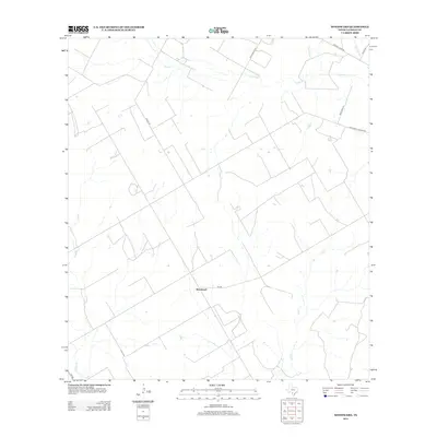
2013 Map of Woodward
USGS Topo · Published 2013About this map
Woodward stands at the center of this South Texas landscape, situated along the path of FM-469 in La Salle County. The geography is defined by a dendritic network of seasonal drainages, including the prominent Cibolo Cr to the north and Salt Cr winding through the south. The rural road system provides a window into local land ownership and ranching history, with thoroughfares such as Solo Ranch Rd, Freddie Copps Rd, and Old Donald Jordan Rd suggesting a pattern of established family holdings. These routes, alongside Carrol Rd, connect isolated homesteads across a terrain marked by intermittent water sources like Mitchell Br and Sage Cr. The map captures the quiet, expansive nature of this ranching country just north of the borderlands, where the sparse settlement pattern reflects the traditional cattle and oil-field economies of the region.
Find a feature on this map
15 named features on this map. Tap any name to fly to it.
Don’t see what you’re looking for? This feature index may not catch every label — zoom into the map to look around manually.
Map Details
Editions of this 2013 Woodward Map
This is the sole edition of this map. No revisions or reprints were ever made.
Other maps of this area

1927 · Bart
USGS Topo · 1:62,500

1929 · Cotulla
USGS Topo · 1:125,000

1940 · Cotulla
USGS Topo · 1:62,500

1940 · Artesia Wells
USGS Topo · 1:62,500

1942 · Dilley
USGS Topo · 1:62,500

1953 · Crystal City
USGS Topo · 1:250,000

1955 · Crystal City
USGS Topo · 1:250,000

1956 · Woodward
USGS Topo · 1:62,500

1961 · Crystal City
USGS Topo · 1:250,000

1968 · Crystal City
USGS Topo · 1:250,000