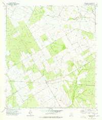
1974 Map of Woodward
USGS Topo · Published 1977About this map
Woodward and the nearby Schulze landing mark this section of the South Texas brush country during the mid-1970s. The landscape is defined by the east-west corridor of the Missouri Pacific railroad, which cuts a straight line through the drainage basins of Cibolo Creek and Sage Creek. The presence of a small Cem and numerous scattered Well sites across the quadrangle indicates the dispersed nature of settlement and the reliance on groundwater for ranching operations in La Salle County.
Find a feature on this map
12 named features on this map. Tap any name to fly to it.
Don’t see what you’re looking for? This feature index may not catch every label — zoom into the map to look around manually.
Map Details
Editions of this 1974 Woodward Map
This is the sole edition of this map. No revisions or reprints were ever made.
Other maps of this area

1927 · Bart
USGS Topo · 1:62,500

1929 · Cotulla
USGS Topo · 1:125,000

1940 · Cotulla
USGS Topo · 1:62,500

1940 · Artesia Wells
USGS Topo · 1:62,500

1942 · Dilley
USGS Topo · 1:62,500

1953 · Crystal City
USGS Topo · 1:250,000

1955 · Crystal City
USGS Topo · 1:250,000

1956 · Woodward
USGS Topo · 1:62,500

1961 · Crystal City
USGS Topo · 1:250,000

1968 · Crystal City
USGS Topo · 1:250,000