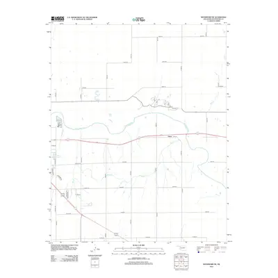
2012 Map of Woodward NE
USGS Topo · Published 2012About this map
The N Canadian River valley and its tributary systems dominate this landscape in Northwest Oklahoma, showing a grid of rural section roads intersected by major transport corridors. The settlement of Alston appears along the eastern reach of Boggy Cr, which winds through the southern half of the quadrangle before joining the main river channel. Water management and recreational features are evident at Crystal Beach Lake, while the local hydrology is further defined by Woodward Cr and Bull Cr. To the southwest, residential developments such as Trailer Villa and street networks including Knight Rd and Hunter Rd mark the transition toward more developed areas. The map illustrates a classic High Plains settlement pattern where modern infrastructure follows the natural course of the river valley.
Find a feature on this map
33 named features on this map. Tap any name to fly to it.
Don’t see what you’re looking for? This feature index may not catch every label — zoom into the map to look around manually.
Map Details
Editions of this 2012 Woodward NE Map
This is the sole edition of this map. No revisions or reprints were ever made.
Other maps of this area

1955 · Woodward
USGS Topo · 1:250,000

1958 · Woodward
USGS Topo · 1:250,000

1969 · Woodward SW
USGS Topo · 1:24,000

1969 · Woodward
USGS Topo · 1:24,000

1969 · Mooreland
USGS Topo · 1:24,000

1969 · Sharon
USGS Topo · 1:24,000

1969 · Woodward NE
USGS Topo · 1:24,000

1969 · Mooreland SW
USGS Topo · 1:24,000

1970 · Fairvalley SW
USGS Topo · 1:24,000

1970 · Sleeping Bear Creek SW
USGS Topo · 1:24,000