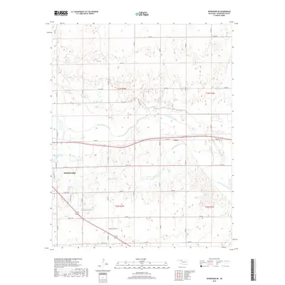
2018 Map of Woodward NE
USGS Topo · Published 2018About this map
The North Canadian River meanders across the landscape of northwest Oklahoma, anchoring the expansion of Woodward and its outlying rural sectors. This 2018 survey captures the area during a period of modern growth, where traditional township lines like t23n r20w meet contemporary infrastructure. The city's eastern edge is marked by notable recreation and residential corridors, including Crystal Beach Lake and developments along Lakeview Dr.
Find a feature on this map
30 named features on this map. Tap any name to fly to it.
Don’t see what you’re looking for? This feature index may not catch every label — zoom into the map to look around manually.
Map Details
Editions of this 2018 Woodward NE Map
This is the sole edition of this map. No revisions or reprints were ever made.
Other maps of this area

1955 · Woodward
USGS Topo · 1:250,000

1958 · Woodward
USGS Topo · 1:250,000

1969 · Woodward SW
USGS Topo · 1:24,000

1969 · Woodward
USGS Topo · 1:24,000

1969 · Mooreland
USGS Topo · 1:24,000

1969 · Sharon
USGS Topo · 1:24,000

1969 · Woodward NE
USGS Topo · 1:24,000

1969 · Mooreland SW
USGS Topo · 1:24,000

1970 · Fairvalley SW
USGS Topo · 1:24,000

1970 · Sleeping Bear Creek SW
USGS Topo · 1:24,000