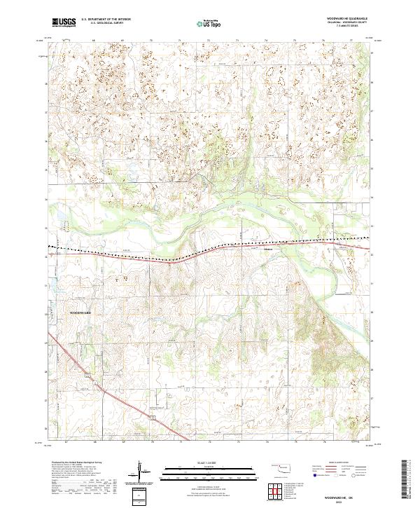
2022 Map of Woodward NE
USGS Topo · Published 2022About this map
The North Canadian River carves a winding path through the landscape northeast of Woodward, defining the topography of this corner of the Oklahoma panhandle. To the east, the small settlement of Alston sits along the e0400 RD corridor, positioned near the river's southern banks. The map captures a mix of developed areas and riparian terrain, including the northern edges of Woodward where Pleasant Valley and the Industrial Park Rd suggest the city's outward growth toward the river valley.
Find a feature on this map
35 named features on this map. Tap any name to fly to it.
Don’t see what you’re looking for? This feature index may not catch every label — zoom into the map to look around manually.
Map Details
Editions of this 2022 Woodward NE Map
This is the sole edition of this map. No revisions or reprints were ever made.
Other maps of this area

1955 · Woodward
USGS Topo · 1:250,000

1958 · Woodward
USGS Topo · 1:250,000

1969 · Woodward SW
USGS Topo · 1:24,000

1969 · Woodward
USGS Topo · 1:24,000

1969 · Mooreland
USGS Topo · 1:24,000

1969 · Sharon
USGS Topo · 1:24,000

1969 · Woodward NE
USGS Topo · 1:24,000

1969 · Mooreland SW
USGS Topo · 1:24,000

1970 · Fairvalley SW
USGS Topo · 1:24,000

1970 · Sleeping Bear Creek SW
USGS Topo · 1:24,000