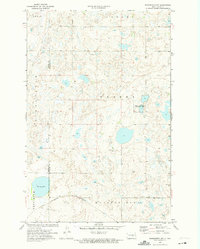
1972 Map of Woodworth NW
USGS Topo · Published 1974About this map
Round Lake sits at the southwestern edge of this 1970s landscape, which is defined by the prairie pothole region's complex network of wetlands and seasonal ponds. The Burlington Northern railroad cuts through the southern section, connecting the rural townships of Marston Moor and Pettibone. This area, bordering the Kidder and Stutsman County line, exhibits a settlement pattern focused on agriculture and conservation, notably within the National Waterfowl Production Area. Local governance and infrastructure are marked by a centrally located Townhall and several wells scattered across the townships of Gerber, Petersville, and Lowery. The presence of a Gravel Pit in the southeast suggests the localized extractive industry supporting road maintenance in this sparsely populated reach of the North Dakota plains.
Find a feature on this map
13 named features on this map. Tap any name to fly to it.
Don’t see what you’re looking for? This feature index may not catch every label — zoom into the map to look around manually.
Map Details
Editions of this 1972 Woodworth NW Map
This is the sole edition of this map. No revisions or reprints were ever made.
Other maps of this area

1952 · New Rockford
USGS Topo · 1:250,000

1956 · New Rockford
USGS Topo · 1:250,000

1971 · New Rockford
USGS Topo · 1:250,000

1972 · Woodworth
USGS Topo · 1:24,000
1972 · Lake Louise
USGS Topo · 1:24,000

1972 · Lake Williams
USGS Topo · 1:24,000
1972 · Pearl Lake
USGS Topo · 1:24,000
1972 · Pettibone
USGS Topo · 1:24,000
1978 · Bowdon SE
USGS Topo · 1:24,000
1978 · Sykeston SW
USGS Topo · 1:24,000