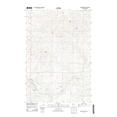
2013 Map of Woolford Creek
USGS Topo · Published 2013About this map
The Kalama River flows through the southern portion of this Washington landscape, punctuated by the Lower Kalama River Falls. This area is defined by its significant relief, with several prominent summits including Goble Mtn, Woolford Mtn, and Wild Horse Peak. The presence of the Kalama Falls Salmon Hatchery along the river highlights the intersection of the natural waterway with local resource management. A complex drainage system feeds the main river, with notable tributaries such as Goble Cr, Wild Horse Cr, and Woolford Cr carving through the terrain. The network of local roads, such as Kalama River Rd and Kelly Rd, provides access to the timbered heights and valleys, reflecting the rural character of Cowlitz County in the early twenty-first century.
Find a feature on this map
33 named features on this map. Tap any name to fly to it.
Don’t see what you’re looking for? This feature index may not catch every label — zoom into the map to look around manually.
Map Details
Editions of this 2013 Woolford Creek Map
This is the sole edition of this map. No revisions or reprints were ever made.
Other maps of this area

1921 · Kalama
USGS Topo · 1:62,500

1922 · St. Helens
USGS Topo · 1:62,500

1940 · La Center
USGS Topo · 1:62,500

1941 · St Helens
USGS Topo · 1:62,500

1943 · Pigeon Springs
USGS Topo · 1:62,500

1943 · St Helens
USGS Topo · 1:62,500

1948 · Vancouver
USGS Topo · 1:250,000

1950 · Vancouver
USGS Topo · 1:250,000

1950 · Vancouver
USGS Topo · 1:250,000

1953 · Hoquiam
USGS Topo · 1:250,000