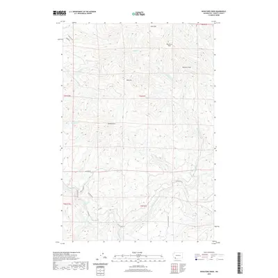
2020 Map of Woolford Creek
USGS Topo · Published 2020About this map
Kalama River flows across the southern reaches of this landscape, a region defined by its prominent volcanic peaks and complex drainage networks in Cowlitz County. The terrain rises sharply to summits like Monument Peak, Wild Horse Peak, and Woolford Mtn, while the river system is fed by numerous tributaries including Little Kalama River, Italian Creek, and Knowlton Cr. A significant landmark in the southwest is the Lower Kalama River Falls, situated near the junctions of several local routes.
Find a feature on this map
27 named features on this map. Tap any name to fly to it.
Don’t see what you’re looking for? This feature index may not catch every label — zoom into the map to look around manually.
Map Details
Editions of this 2020 Woolford Creek Map
This is the sole edition of this map. No revisions or reprints were ever made.
Other maps of this area

1921 · Kalama
USGS Topo · 1:62,500

1922 · St. Helens
USGS Topo · 1:62,500

1940 · La Center
USGS Topo · 1:62,500

1941 · St Helens
USGS Topo · 1:62,500

1943 · Pigeon Springs
USGS Topo · 1:62,500

1943 · St Helens
USGS Topo · 1:62,500

1948 · Vancouver
USGS Topo · 1:250,000

1950 · Vancouver
USGS Topo · 1:250,000

1950 · Vancouver
USGS Topo · 1:250,000

1953 · Hoquiam
USGS Topo · 1:250,000