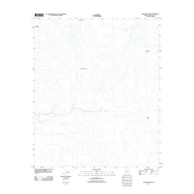
2011 Map of Woolsey Peak
USGS Topo · Published 2011About this map
Woolsey Peak and the high desert terrain of Maricopa County define this corner of Arizona, where the land is carved by an intricate network of drainage systems. At the center of the local hydrology is Woolsey Wash, which snakes across the landscape toward the life-sustaining Woolsey Spring. The map documents a sparsely settled region, highlighting the remote settlement of Harqua in the northwest. Prominent peaks and buttes serve as the primary landmarks for navigation, including the massive Signal Mountain and Webb Mountain. Small-scale water management is evident at Jagow Tank, a vital feature in this arid environment. The arrangement of these natural features and limited human improvements illustrates the enduring character of the Sonoran desert during the early twenty-first century.
Find a feature on this map
8 named features on this map. Tap any name to fly to it.
Don’t see what you’re looking for? This feature index may not catch every label — zoom into the map to look around manually.
Map Details
Editions of this 2011 Woolsey Peak Map
This is the sole edition of this map. No revisions or reprints were ever made.
Other maps of this area

1942 · Vicksburg
USGS Topo · 1:250,000

1951 · Dendora Valley
USGS Topo · 1:62,500

1951 · Woolsey Peak
USGS Topo · 1:62,500

1954 · Phoenix
USGS Topo · 1:250,000

1957 · Phoenix
USGS Topo · 1:250,000

1958 · Phoenix
USGS Topo · 1:250,000

1960 · Phoenix
USGS Topo · 1:250,000

1962 · Cortez Peak
USGS Topo · 1:62,500

1962 · Arlington
USGS Topo · 1:62,500

1969 · Phoenix
USGS Topo · 1:250,000