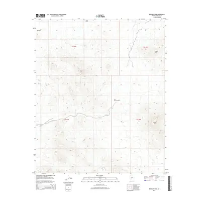
2014 Map of Woolsey Peak
USGS Topo · Published 2014About this map
Woolsey Peak stands as the prominent centerpiece of this southwestern Arizona landscape, part of the extensive Gila Bend Mountains. The area is defined by a series of significant volcanic and metamorphic landmarks, including Signal Mtn and Black Butte, which rise sharply above the desert floor. The drainage patterns of the region are dominated by Woolsey Wash, which meanders through the central and western portions of the quadrangle. A rare water source, Woolsey Spring, is located near the peak that bears its name, providing a vital point of interest in this arid environment. The map also captures the settlement at Harqua in the northwest, offering a detailed view of the survey lines and section boundaries that define the public land system in Maricopa County during the early twenty-first century.
Find a feature on this map
12 named features on this map. Tap any name to fly to it.
Don’t see what you’re looking for? This feature index may not catch every label — zoom into the map to look around manually.
Map Details
Editions of this 2014 Woolsey Peak Map
This is the sole edition of this map. No revisions or reprints were ever made.
Other maps of this area

1942 · Vicksburg
USGS Topo · 1:250,000

1951 · Dendora Valley
USGS Topo · 1:62,500

1951 · Woolsey Peak
USGS Topo · 1:62,500

1954 · Phoenix
USGS Topo · 1:250,000

1957 · Phoenix
USGS Topo · 1:250,000

1958 · Phoenix
USGS Topo · 1:250,000

1960 · Phoenix
USGS Topo · 1:250,000

1962 · Cortez Peak
USGS Topo · 1:62,500

1962 · Arlington
USGS Topo · 1:62,500

1969 · Phoenix
USGS Topo · 1:250,000