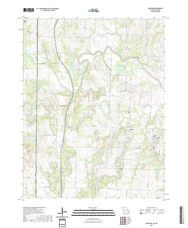
2021 Map of Worland
USGS Topo · Published 2021About this map
The Marais des Cygnes River meanders through this portion of the Missouri-Kansas border, carving a landscape defined by its many tributaries like Mulberry Cr and Walnut Cr. This region of Bates County is anchored by the small settlements of Worland and Foster, connected by a network of rural routes such as State Line Road and State Hwy V. The map reveals a deeply rooted local history through its preservation of family and community landmarks, including Salem Cem and Woodfin Cem. Distinctive crossings like the State Line Bridge and Marble Bridge highlight the historical necessity of navigating the river's winding path between Linn and Bates counties. The density of cemeteries and small-scale creek systems like Gillum Cr and New Home Cr suggests a persistent agricultural character that has defined the borderlands for generations.
Find a feature on this map
68 named features on this map. Tap any name to fly to it.
Don’t see what you’re looking for? This feature index may not catch every label — zoom into the map to look around manually.
Map Details
Editions of this 2021 Worland Map
This is the sole edition of this map. No revisions or reprints were ever made.
Other maps of this area

1887 · Butler
USGS Topo · 1:125,000

1887 · Mound City
USGS Topo · 1:125,000

1893 · Mound City
USGS Topo · 1:125,000

1894 · Butler
USGS Topo · 1:125,000

1937 · New Home
USGS Topo · 1:24,000

1938 · Worland
USGS Topo · 1:24,000

1940 · Worland
USGS Topo · 1:24,000

1940 · Hume
USGS Topo · 1:24,000

1942 · Hume
USGS Topo · 1:24,000
1942 · Sprague
USGS Topo · 1:24,000