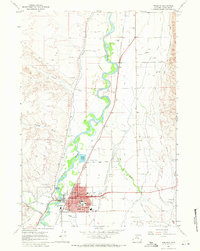
1967 Map of Worland
USGS Topo · Published 1971About this map
Worland serves as a hub of civic and educational life in the Big Horn Basin, dominated by its grid of residential streets and essential community institutions like the Courthouse, Washakie Mem Hosp, and the Armory. The landscape is a study in desert reclamation, where the winding Bighorn River is flanked by an intricate network of irrigation including the Bighorn Canal and Upper Hanover Canal. These man-made waterways support agriculture on the flat valley floor, contrasting sharply with the dry, dissected terrain of Fifteenmile Creek and Crooked Draw to the west.
Find a feature on this map
54 named features on this map. Tap any name to fly to it.
Don’t see what you’re looking for? This feature index may not catch every label — zoom into the map to look around manually.
Map Details
Editions of this 1967 Worland Map
3 editions found
Other maps of this area

1945 · Kirby
USGS Topo · 1:62,500

1946 · Kirby
USGS Topo · 1:62,500

1951 · Schuster Flats NE
USGS Topo · 1:24,000

1951 · Schuster Flats SE
USGS Topo · 1:24,000

1955 · Cody
USGS Topo · 1:250,000

1955 · Thermopolis
USGS Topo · 1:250,000

1955 · Sheridan
USGS Topo · 1:250,000

1955 · Arminto
USGS Topo · 1:250,000

1958 · Cody
USGS Topo · 1:250,000

1958 · Thermopolis
USGS Topo · 1:250,000