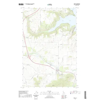
2020 Map of Worley
USGS Topo · Published 2020About this map
Worley serves as a primary hub in this Kootenai County landscape, positioned along the highway and rail corridor that cuts through the rolling terrain south of Coeur d'Alene Lake. The map reveals a transition from the agricultural plateaus around Mozart and Warners Mtn to the deeply indented shoreline of the lake to the north. Numerous coves, including Rockford Bay, Sun Up Bay, and the uniquely named 16 to 1 Bay, show a pattern of modern residential development and access roads like S Windy Bay Rd and Cordillera Dr winding down to the water.
Find a feature on this map
69 named features on this map. Tap any name to fly to it.
Don’t see what you’re looking for? This feature index may not catch every label — zoom into the map to look around manually.
Map Details
Editions of this 2020 Worley Map
This is the sole edition of this map. No revisions or reprints were ever made.
Other maps of this area

1901 · Spokane
USGS Topo · 1:125,000

1903 · Oakesdale
USGS Topo · 1:125,000

1903 · Rathdrum
USGS Topo · 1:125,000

1905 · Oakesdale
USGS Topo · 1:125,000

1949 · Greenacres
USGS Topo · 1:62,500

1951 · Greenacres
USGS Topo · 1:62,500

1954 · Fairfield
USGS Topo · 1:62,500

1955 · Spokane
USGS Topo · 1:250,000

1957 · Plummer
USGS Topo · 1:62,500

1957 · Coeur D'Alene
USGS Topo · 1:62,500