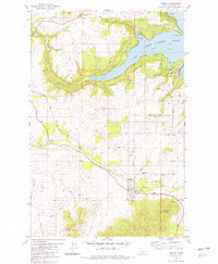
1981 Map of Worley
USGS Topo · Published 1982About this map
Coeur D'Alene Lake and its intricate bays dominate this portion of Kootenai County, where the jagged shoreline meets the uplands of the Worley Mtn and Warners Mtn range. The settlement of Worley serves as a local hub, situated at a junction where the Union Pacific railroad corridor cuts through the landscape. Agricultural and industrial footprints are evident through the presence of Grain Elevators and Storage Bins near the tracks, while smaller settlements like Amwaco and Mozart provide further evidence of the area's development.
Find a feature on this map
41 named features on this map. Tap any name to fly to it.
Don’t see what you’re looking for? This feature index may not catch every label — zoom into the map to look around manually.
Map Details
Editions of this 1981 Worley Map
This is the sole edition of this map. No revisions or reprints were ever made.
Other maps of this area

1901 · Spokane
USGS Topo · 1:125,000

1903 · Oakesdale
USGS Topo · 1:125,000

1903 · Rathdrum
USGS Topo · 1:125,000

1905 · Oakesdale
USGS Topo · 1:125,000

1949 · Greenacres
USGS Topo · 1:62,500

1951 · Greenacres
USGS Topo · 1:62,500

1954 · Fairfield
USGS Topo · 1:62,500

1955 · Spokane
USGS Topo · 1:250,000

1957 · Plummer
USGS Topo · 1:62,500

1957 · Coeur D'Alene
USGS Topo · 1:62,500