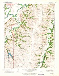
1964 Map of Wreford
USGS Topo · Published 1965About this map
The Smoky Hill River meanders through the heart of this mid-1960s landscape, flanked by a prominent levee system and the Union Pacific railroad line. This area of Geary County is defined by its watercourses, where Clarks Creek and Lyon Creek carve through the terrain of Blakely and Jefferson townships. The settlement of Wreford stands as a central point of reference, surrounded by evidence of early local community life, including several family-named burial grounds such as Wetzel Cem and Salchow Cem. Public land is well-represented by Geary County State Park and Logan Grove Park, reflecting a balance between agricultural land use and recreational preservation. A localized Quarry and the Radio Tower (KJCK) provide specific landmarks that help orient the viewer within this 1964 survey.
Find a feature on this map
19 named features on this map. Tap any name to fly to it.
Don’t see what you’re looking for? This feature index may not catch every label — zoom into the map to look around manually.
Map Details
Editions of this 1964 Wreford Map
This is the sole edition of this map. No revisions or reprints were ever made.
Other maps of this area

1886 · Junction City
USGS Topo · 1:125,000

1889 · Junction City
USGS Topo · 1:125,000

1889 · Parkerville
USGS Topo · 1:125,000

1894 · Junction City
USGS Topo · 1:125,000

1894 · Parkerville
USGS Topo · 1:125,000

1947 · Manhattan
USGS Topo · 1:62,500

1947 · Fort Riley
USGS Topo · 1:62,500

1950 · Junction City
USGS Topo · 1:24,000

1950 · Alida
USGS Topo · 1:24,000

1951 · Ogden
USGS Topo · 1:24,000