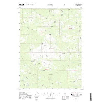
2018 Map of Wrights Ridge
USGS Topo · Published 2018About this map
The Middle Fork Eel River winds through the heart of the Mendocino National Forest in this Trinity County wilderness, where the high-elevation landscape is defined by a complex network of ridges and remote valleys. Deep within this mountainous terrain, named features like Wrights Valley and Georges Valley suggest small pockets of level ground between the steep slopes of Wrights Ridge and Buck Ridge. This 2018 survey reveals a landscape largely shaped by its hydrology, featuring small alpine water bodies such as Lucky Lake and Henthorne Lake, alongside the curious topographical depression known as Hole in the Ground. Connectivity in this isolated region is marked by primitive crossings and landmarks, including the Hoxie Crossing and the Fern Point Bridge, which provide rare access points across the river system for those navigating the forest's extensive ridge-and-canyon system.
Find a feature on this map
57 named features on this map. Tap any name to fly to it.
Don’t see what you’re looking for? This feature index may not catch every label — zoom into the map to look around manually.
Map Details
Editions of this 2018 Wrights Ridge Map
This is the sole edition of this map. No revisions or reprints were ever made.
Other maps of this area

1890 · Red Bluff
USGS Topo · 1:250,000

1894 · Red Bluff
USGS Topo · 1:250,000

1926 · Covelo
USGS Topo · 1:62,500

1931 · Hoaglin
USGS Topo · 1:96,000

1935 · Hoaglin
USGS Topo · 1:125,000

1952 · Covelo
USGS Topo · 1:62,500

1952 · Anthony Peak
USGS Topo · 1:62,500

1953 · Blackrock Mtn
USGS Topo · 1:62,500

1954 · Blackrock Mtn
USGS Topo · 1:62,500

1954 · Yolla Bolly
USGS Topo · 1:62,500