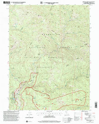
1995 Map of Wrights Ridge
USGS Topo · Published 2001About this map
Mendocino National Forest and the Yolla Bolly Middle Eel Wilderness dominate this high-elevation landscape in Trinity County. The terrain is defined by a series of parallel ridgelines, including Wrights Ridge and Schoolmarm Ridge, which channel water into the Middle Fork Eel River. This remote region contains several seasonal camps and stations that speak to the forest management and backcountry recreation of the mid-1990s, such as the Indian Dick FS Station and Rock Cabin. The placement of Flournoy Cabin and Haynes Delight suggests early settlement or grazing claims deep within the forest interior. Water sources are critical landmarks here, with names like Sulphur Camp and Cherry Camp Spring indicating historical use by hunters and travelers traversing the many miles of trails shown throughout the quadrangle.
Find a feature on this map
49 named features on this map. Tap any name to fly to it.
Don’t see what you’re looking for? This feature index may not catch every label — zoom into the map to look around manually.
Map Details
Editions of this 1995 Wrights Ridge Map
This is the sole edition of this map. No revisions or reprints were ever made.
Other maps of this area

1890 · Red Bluff
USGS Topo · 1:250,000

1894 · Red Bluff
USGS Topo · 1:250,000

1926 · Covelo
USGS Topo · 1:62,500

1931 · Hoaglin
USGS Topo · 1:96,000

1935 · Hoaglin
USGS Topo · 1:125,000

1952 · Covelo
USGS Topo · 1:62,500

1952 · Anthony Peak
USGS Topo · 1:62,500

1953 · Blackrock Mtn
USGS Topo · 1:62,500

1954 · Blackrock Mtn
USGS Topo · 1:62,500

1954 · Yolla Bolly
USGS Topo · 1:62,500