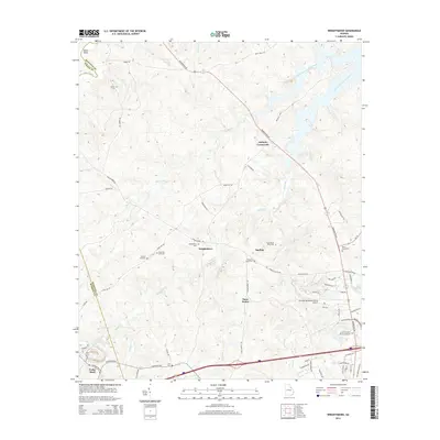
2014 Map of Wrightsboro
USGS Topo · Published 2014About this map
Wrightsboro and the surrounding McDuffie County countryside are defined by a network of creeks and legacy roads that bridge the transition from upland ridges to the J. Storm Thurmond Reservoir. The map documents a landscape deeply rooted in its local heritage, featuring numerous small burial grounds such as Wrightsboro Cem, Liberty Hill Cem, and New Zion Hill Cem. These sites, along with small junctions like Anthony Crossroads and Three Points, highlight a pattern of rural settlement that has persisted through the decades. The southern portion of the sheet shows modern infrastructure development, including the Thomson-McDuffie County Airport and the corridor of the Washington Hwy, while the northern reaches remain dominated by the fingers of the reservoir and drainage basins like Hart Creek and Middle Creek.
Find a feature on this map
70 named features on this map. Tap any name to fly to it.
Don’t see what you’re looking for? This feature index may not catch every label — zoom into the map to look around manually.
Map Details
Editions of this 2014 Wrightsboro Map
This is the sole edition of this map. No revisions or reprints were ever made.
Other maps of this area

1892 · Mc Cormick
USGS Topo · 1:125,000

1906 · Crawfordville
USGS Topo · 1:125,000

1912 · Mc Cormick
USGS Topo · 1:125,000

1921 · Appling
USGS Topo · 1:62,500

1922 · Harlem
USGS Topo · 1:62,500

1943 · Appling
USGS Topo · 1:62,500

1948 · Harlem
USGS Topo · 1:62,500

1948 · Thomson East
USGS Topo · 1:24,000

1950 · Dearing
USGS Topo · 1:24,000

1953 · Athens
USGS Topo · 1:250,000