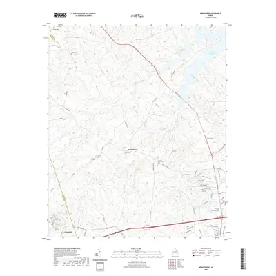
2020 Map of Wrightsboro
USGS Topo · Published 2020About this map
Wrightsboro and its surrounding countryside are defined by a network of historic burial grounds and intricate watercourses. This area along the McDuffie and Warren county line showcases a transition from traditional agricultural landscapes to modern infrastructure, such as the Thomson-Mcduffie County Airport. Genealogy researchers will find significant value in the numerous family and community cemeteries scattered throughout the terrain, including Wrightsboro Cem, New Zion Hill Cem, and the Rees-Wade-Short Cem. The northern reach of the map is dominated by the sprawling waters of the J. Strom Thurmond Reservoir, which has altered the original flow of the Little River and its tributaries like Broom Cr. Further south, the settlement of Cedar Rock sits near the intersection of Cedar Rock Rd and Sally White Rd, where the landscape is drained by Childers Cr and Todds Br.
Find a feature on this map
70 named features on this map. Tap any name to fly to it.
Don’t see what you’re looking for? This feature index may not catch every label — zoom into the map to look around manually.
Map Details
Editions of this 2020 Wrightsboro Map
This is the sole edition of this map. No revisions or reprints were ever made.
Other maps of this area

1892 · Mc Cormick
USGS Topo · 1:125,000

1906 · Crawfordville
USGS Topo · 1:125,000

1912 · Mc Cormick
USGS Topo · 1:125,000

1921 · Appling
USGS Topo · 1:62,500

1922 · Harlem
USGS Topo · 1:62,500

1943 · Appling
USGS Topo · 1:62,500

1948 · Harlem
USGS Topo · 1:62,500

1948 · Thomson East
USGS Topo · 1:24,000

1950 · Dearing
USGS Topo · 1:24,000

1953 · Athens
USGS Topo · 1:250,000