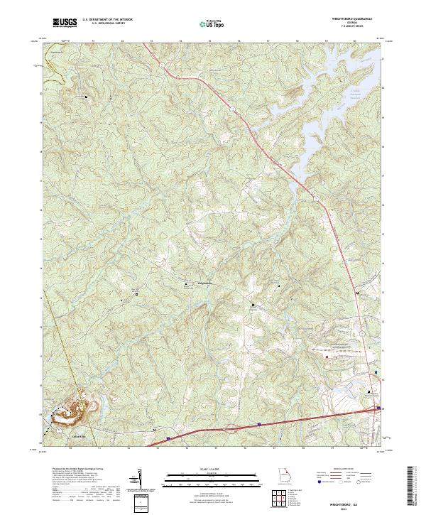
2024 Map of Wrightsboro
USGS Topo · Published 2024About this map
Wrightsboro and the surrounding McDuffie County landscape are defined by a network of historic burial grounds and the modern presence of the Thomson-McDuffie County Airport. The terrain is deeply etched by watercourses like Hart Creek and Middle Creek, which converge as they flow toward the expansive J. Strom Thurmond Reservoir in the northeast corner. This contemporary map documents a rural-suburban hybrid, where old family and church landmarks such as Liberty Hill Cem and Wrightsboro Church Cem coexist with newer developments and infrastructure.
Find a feature on this map
68 named features on this map. Tap any name to fly to it.
Don’t see what you’re looking for? This feature index may not catch every label — zoom into the map to look around manually.
Map Details
Editions of this 2024 Wrightsboro Map
This is the sole edition of this map. No revisions or reprints were ever made.
Other maps of this area

1892 · Mc Cormick
USGS Topo · 1:125,000

1906 · Crawfordville
USGS Topo · 1:125,000

1912 · Mc Cormick
USGS Topo · 1:125,000

1921 · Appling
USGS Topo · 1:62,500

1922 · Harlem
USGS Topo · 1:62,500

1943 · Appling
USGS Topo · 1:62,500

1948 · Harlem
USGS Topo · 1:62,500

1948 · Thomson East
USGS Topo · 1:24,000

1950 · Dearing
USGS Topo · 1:24,000

1953 · Athens
USGS Topo · 1:250,000